• Warming trend on the way for much of the Northeast, Great Lakes and Southeast U.S. starting this weekend through Tuesday
• A series of storms will bring rounds of rain from Texas and the Gulf Coast states through the Southeast, then into the Northeast next week, with the potential for snow in parts of the interior Northeast and Appalachians
• AccuWeather Long-Range Experts expect milder air in mid-December, followed by another pattern shift with colder air and opportunities for snow ahead of the holidays
AccuWeather Global Weather Center – Dec. 6, 2024 – Following an early-December deep freeze across much of the Northeast and Great Lakes that brought areas of snow to the regions and chilly air to the Southeast, AccuWeather Long-Range Experts are forecasting a warming trend and a wet and stormy pattern for much of the eastern United States next week.
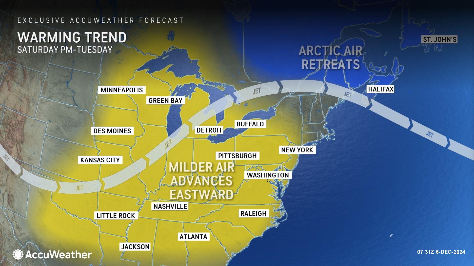
“It’s going to be a temperature roller coaster for much of Northeast,” AccuWeather Long-Range Expert Joe Lundberg said. “It’s going to get mild, then a cold front rolls through, then it gets mild again by next weekend.”
Weekend: snow in the north, rain along the Gulf Coast
An Arctic blast that brought frigid air and feet of lake-effect snow to parts of the Great Lakes and interior Northeast is easing its grip on the region this weekend.
AccuWeather expert meteorologists are forecasting a clipper-style storm to drop southeastward from central Canada to southern Ontario on Saturday and then northern New England on Sunday.
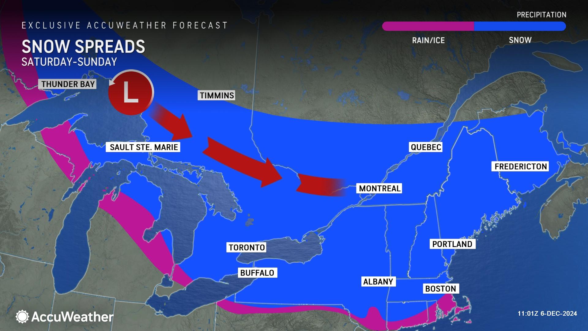
“This fast-moving storm will have enough moisture to squeeze out 1-3 inches of snow from northwestern Ontario to northern New York and northern New England, with local amounts of 3-6 inches, especially over some of the mountains,” AccuWeather Meteorologist Grady Gilman said.
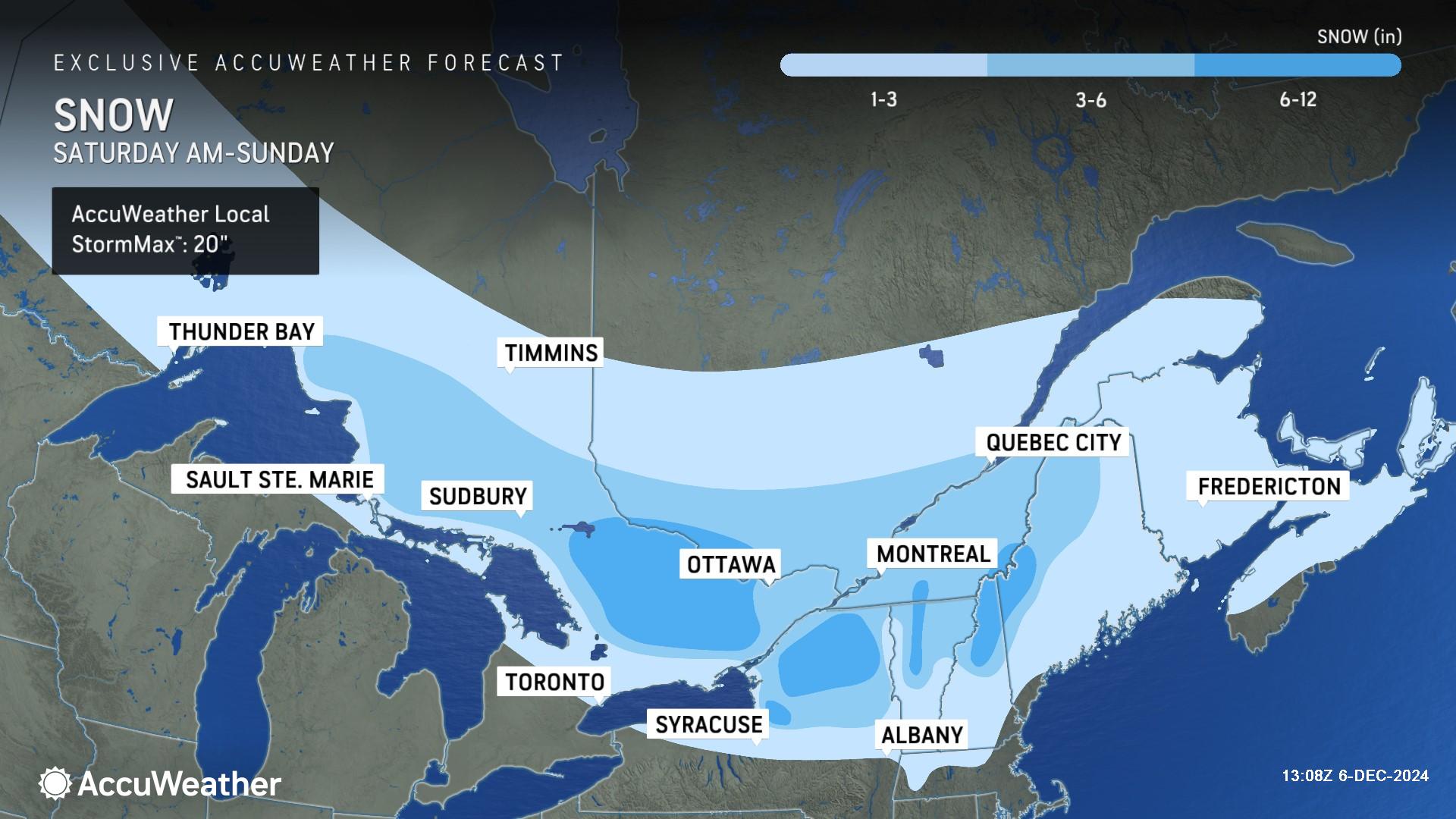
On the southern edge of the snow will be some rain, sleet and freezing rain from parts of northern Michigan to the southern tier of New York and central New England, Gilman added.
The next storm on the horizon will swing up from the southern Plains and the Gulf of Mexico. With milder air in front of the storm, most precipitation will fall in the form of rain from Texas to Kentucky through much of the Mississippi Valley, AccuWeather Lead Long-Range Expert Paul Pastelok said.
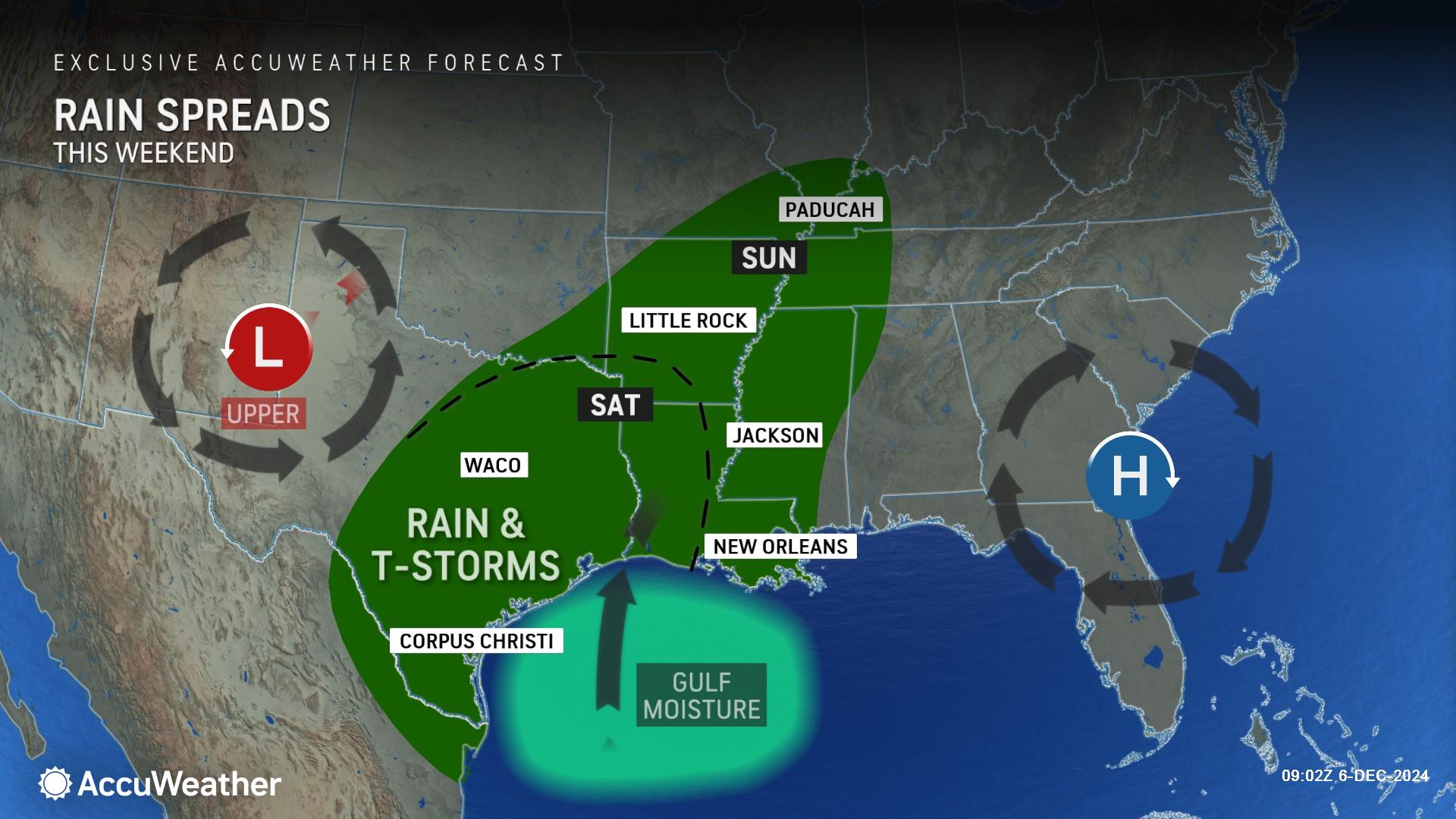
“Exceptions will be the northern tier of the Northeast, where just enough chilly air will linger on the backside of the clipper storm to cause some trouble in the form of a mixture of snow, ice and rain,” Pastelok said.
Next Week: wet and stormy pattern
AccuWeather expert meteorologists are forecasting a series of storms from Sunday through Thursday to bring drenching rain to many areas in the southern and eastern United States.
“It’s going to be a wet and stormy week along the East Coast,” AccuWeather Chief On-Air Meteorologist Bernie Rayno said.
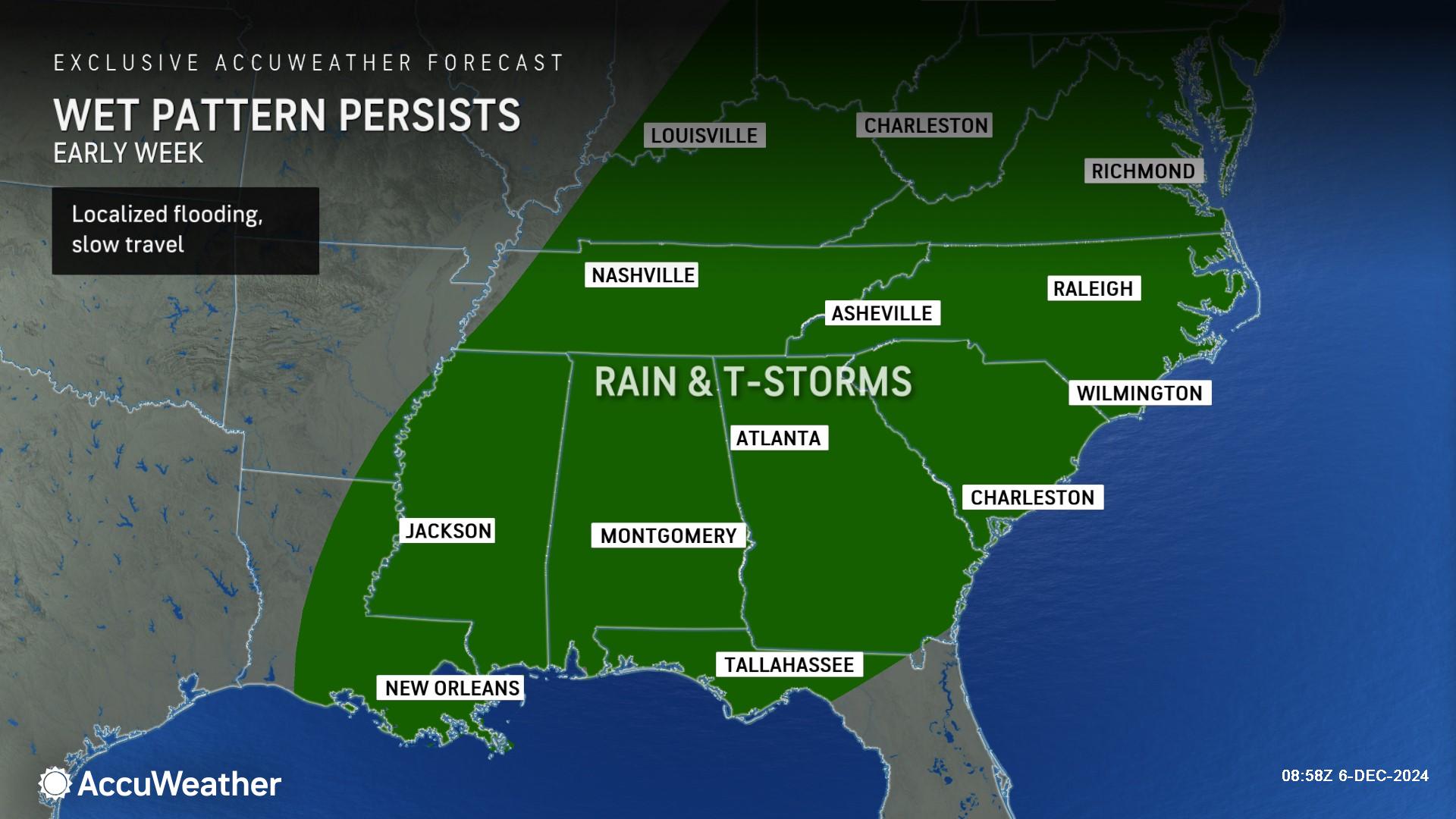
Just enough cold air may sneak in to bring some snow to parts of the Midwest and Appalachians, along with episodes of rain, drizzle and fog.
The first storm in a trio may bring a bit of ice or a wintry mix encompassing rain, snow and ice on the front end to northern New England from Sunday to Monday and rain to most areas in the East.
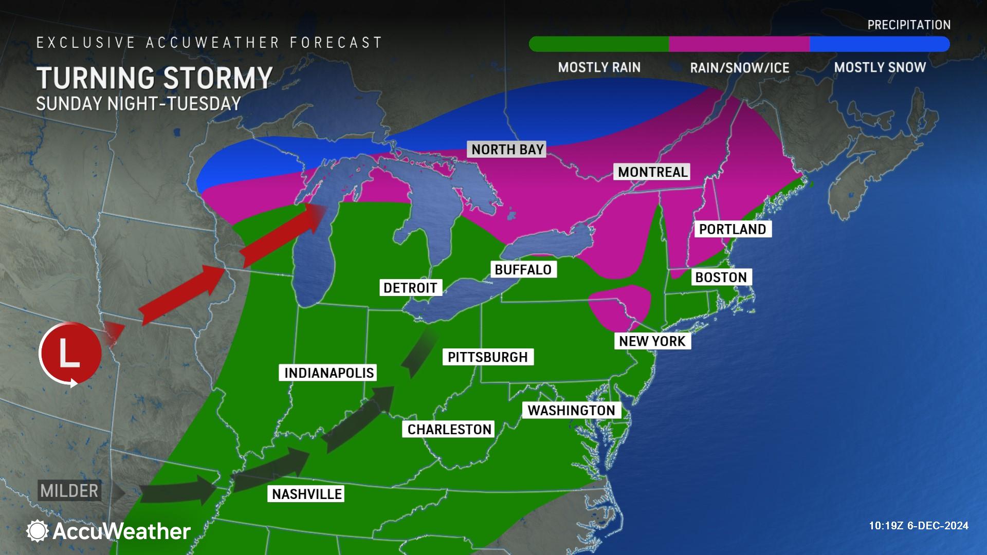
A trailing storm is expected to remain relatively weak and will likely travel to the Northeast along the Appalachians from Monday night to Tuesday night. Because that storm will remain weak, it will bring rain to most areas once again, from the central Gulf coast to parts of the Tennessee and Ohio valleys, Appalachians and Atlantic coast.
The beginnings of a third storm will take shape in the Northwest late this week. This Pacific storm will then slide southeastward across the interior West this weekend to early next week. As it does, it will produce snow over some of the mountain ranges, including the Rockies and the Wasatch Range.
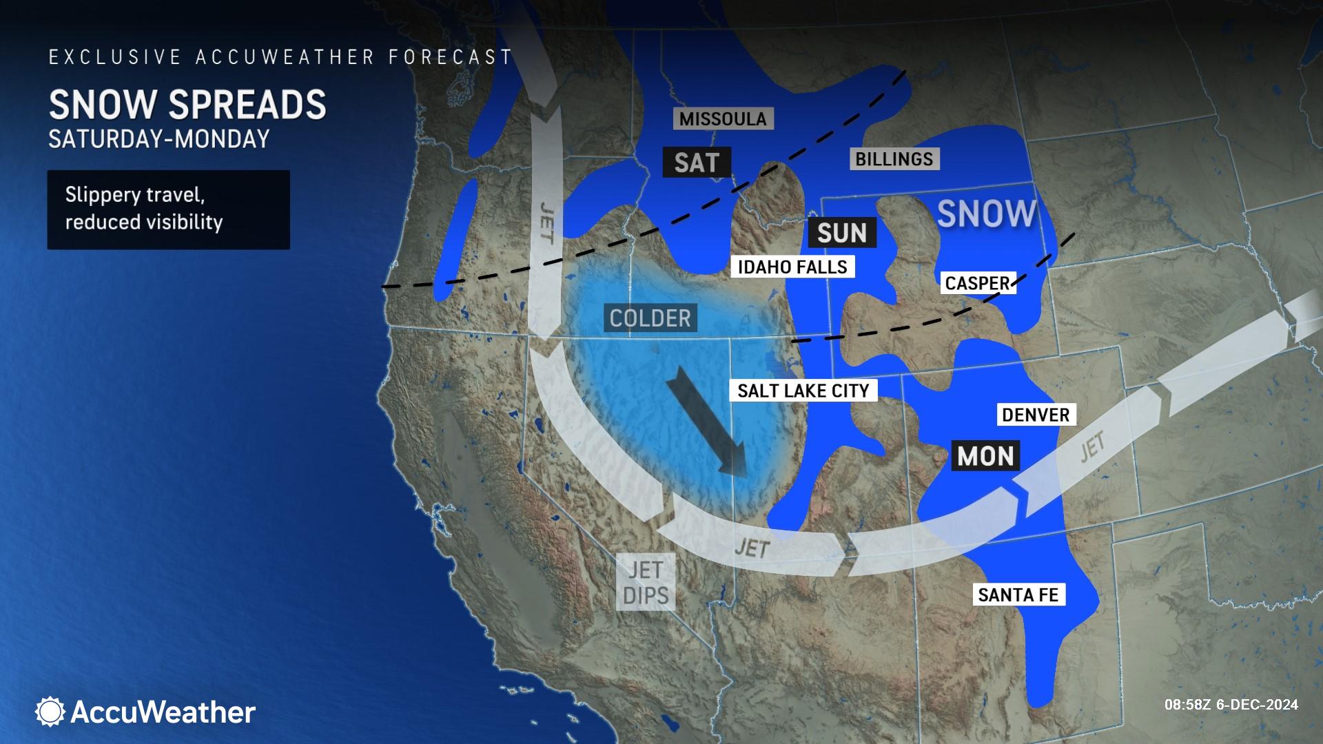
This storm could bring a bit of snow to Denver from Sunday night to Monday. It is possible the morning rush hour in Denver could be impacted with delays.
The energy from the storm in the West will trigger the third storm for the East from Wednesday to Thursday.
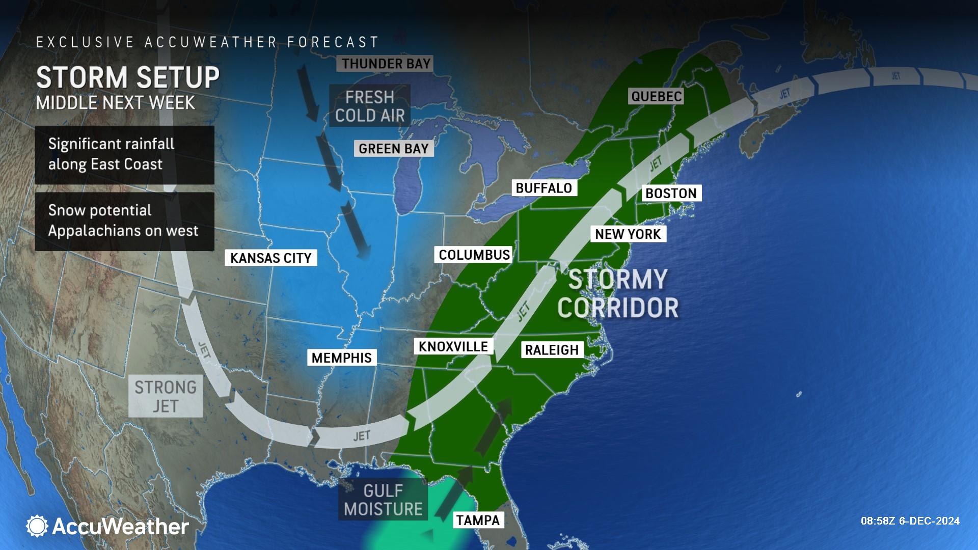
AccuWeather expert meteorologists say this final storm in the series could be the strongest. It will be too warm for snow along the Atlantic Seaboard, but enough cold air could seep into the Appalachians to areas a bit farther west over the Midwest to bring some snow to these areas, depending on the storm track and strength.
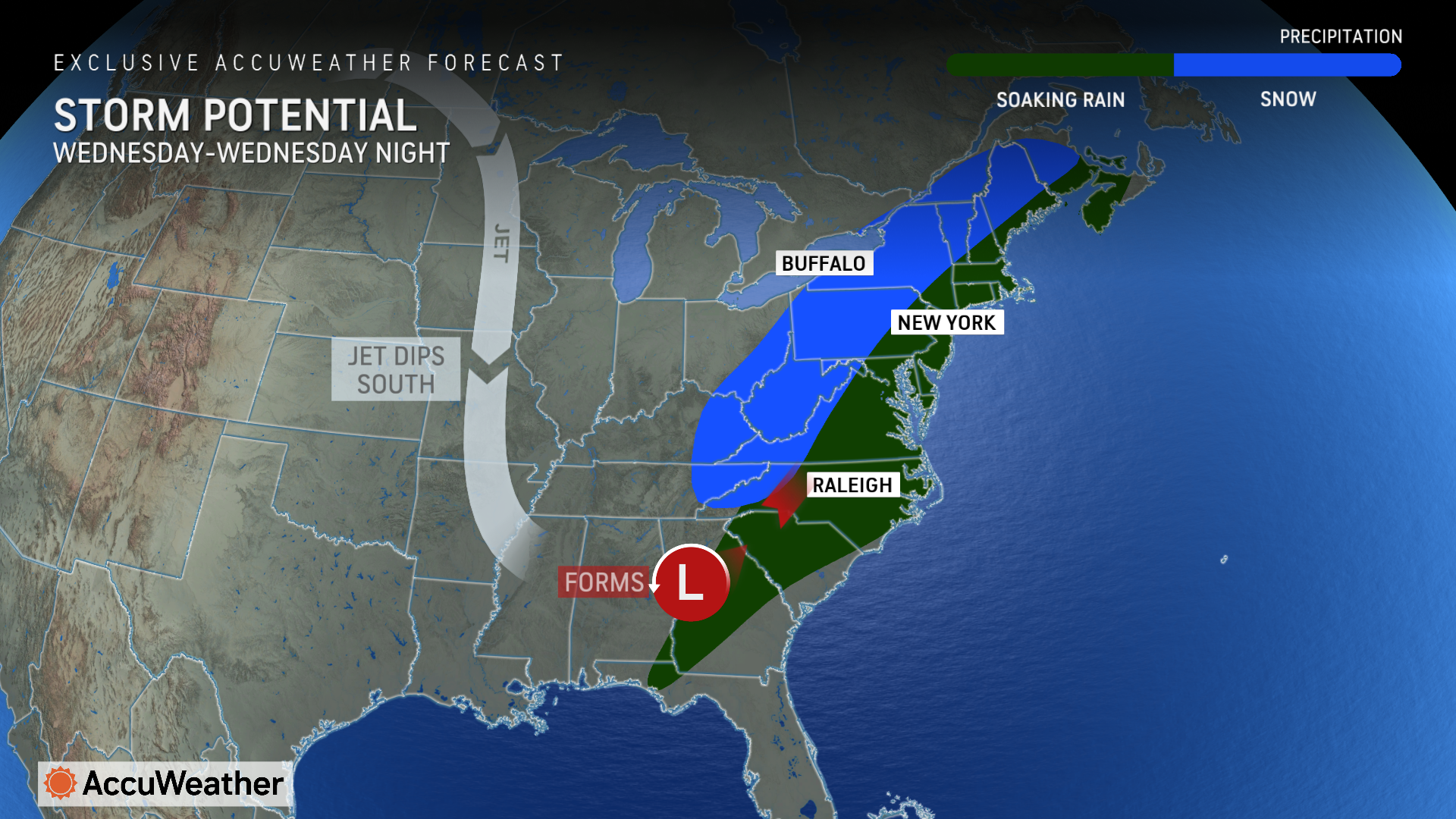
“We expect a soaking rain up the Eastern Seaboard, and there could be cold enough air on the back side of the storm for snow in parts of the interior Northeast. Some areas could see an accumulating snow by Wednesday night,” Lundberg said.
Will colder air return for the holidays?
AccuWeather long-range experts are forecasting a milder Pacific air mass for much of the country for mid-December, followed by another pattern change with colder air returning to much of the Great Lakes and eastern U.S. ahead of the holidays.
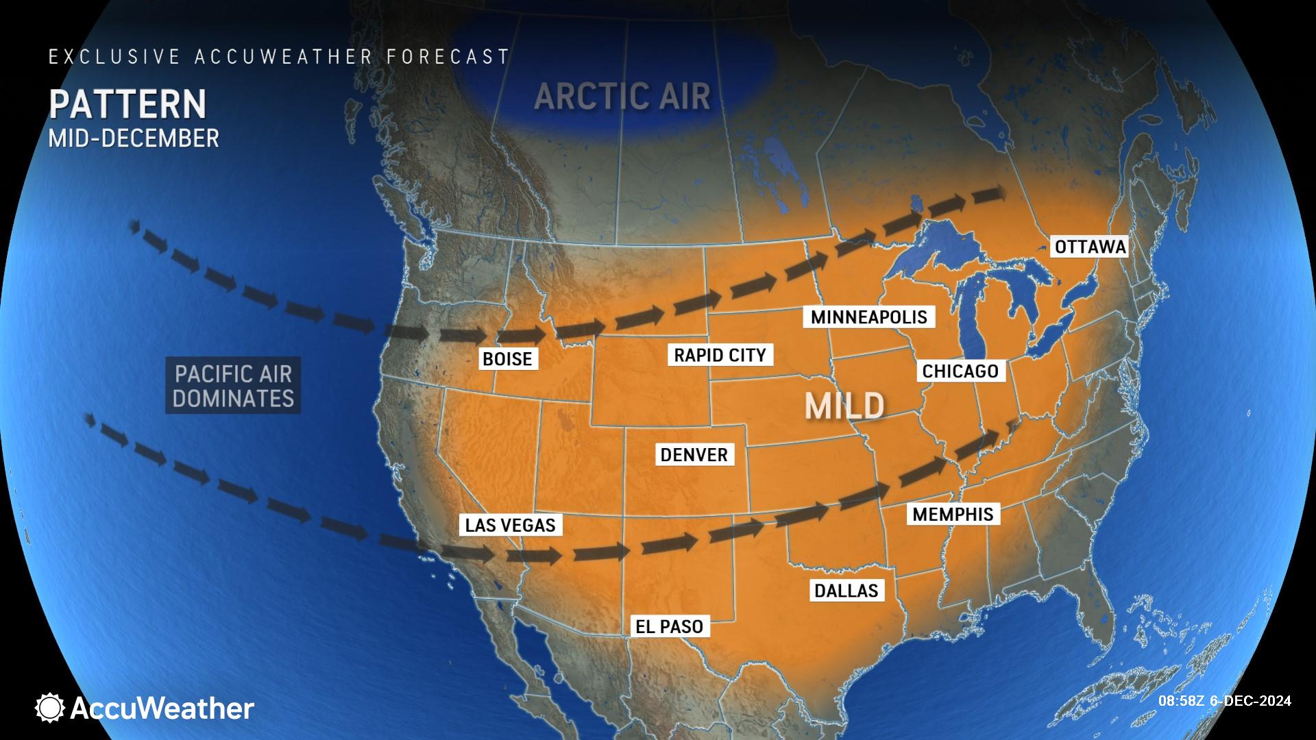
“The jet stream is expected to dip back to the south in late December, bringing a colder and stormier pattern for much of the country that could bring some wintry weather in time for Christmas,” Lundberg said.
AccuWeather will issue the 2024 white Christmas forecast in mid-December.
Additional AccuWeather Resources:
Upcoming December warming trend to include storms in eastern US
Storm train could bring sneaky snow to parts of eastern, central US


